Story by Bill McCarthy
October 13, 2024
Ka‘ena or Ka‘ena Point is the westernmost tip of the island of O‘ahu. In Hawaiian, ka‘ena means “the heat”. According to ancient Hawaiian folklore, Ka‘ena Point is the launching ground for the committed stride of souls leaving this world. The area around the shore rocks was called the leaping place for souls. As you lay dying, your soul left your body and wandered about aimlessly until it climbed this rock and leaped into the ocean…to be caught in mid-air by the ancestors. When that happened, you then died. It seems the ancestors won’t let you bring fear into death. As this is the most western part of the island, it’s where the darkness starts. It is human destiny to have minds working fear and God, and also adventures with kayaks and paddles. As it happened, three kayakers decided to venture around this point in an 8-9 mile paddle. Sandy Johnson, Bill McCarthy and the instigator, the man with the expedition clipboard, Stan Dalbec. I can report that we spent more energy pre-positioning our cars for the ride home than preparing for an intimate oceanic leaping upon our eventual death.
Like the Ko‘olau Mountain Range on the eastern side of O‘ahu , the Wai‘anae Mountain Range is not a mountain range per definition. Both ranges are created from single volcanoes rather than plate tectonics. In 2014 it was found that O‘ahu was actually formed by the eruptions of three volcanoes, not just the Ko‘olau and Wai‘anae. A precursor volcano, named “Ka‘ena”, like in Ka‘ena Point, was a massive shield volcano, and the first to form O‘ahu. It’s now submerged thousands of feet under the sea. This Ka‘ena volcano erupted below our paddle route around Ka‘ena Point about 5 million years ago. The Wai‘anae volcano was the second oldest on O‘ahu, growing on Ka‘ena’s flanks about 4 million years ago; the youngest volcano was Ko‘olau, erupting on the flanks of Waianae about a million years later. At one point in O‘ahu’s geologic history all three volcanoes stood together high above sea level. Ka‘ena, the shortest of the trio, rose about 3,000 feet. All that remains of Ka‘ena volcano today is a long ridge under the sea, extending westward from Ka‘ena Point with half of the underwater ridge covered by younger lava from the Wai‘anae volcano. The sheer size of Ka‘ena’s remnants suggest O‘ahu once was about two times larger than it is today.
In 1956 a military plane flying to O‘ahu reported brown pumice floating on the water and a smell of sulfur. Subsequent flights were flown out, and pilots reported yellow-colored water around Ka‘ena Ridge. Within days, brown pumice began washing up on the shores of O‘ahu, and dead whales were reported around the area. So volcanism has occurred in the past 1,000 years. The nearby peak at Ka‘ala, is now the highest peak on O‘ahu at 4,025 feet. Like the sun, these mountains play a role in navigating an ocean kayak. The environment becomes a range of triggers for travelers.
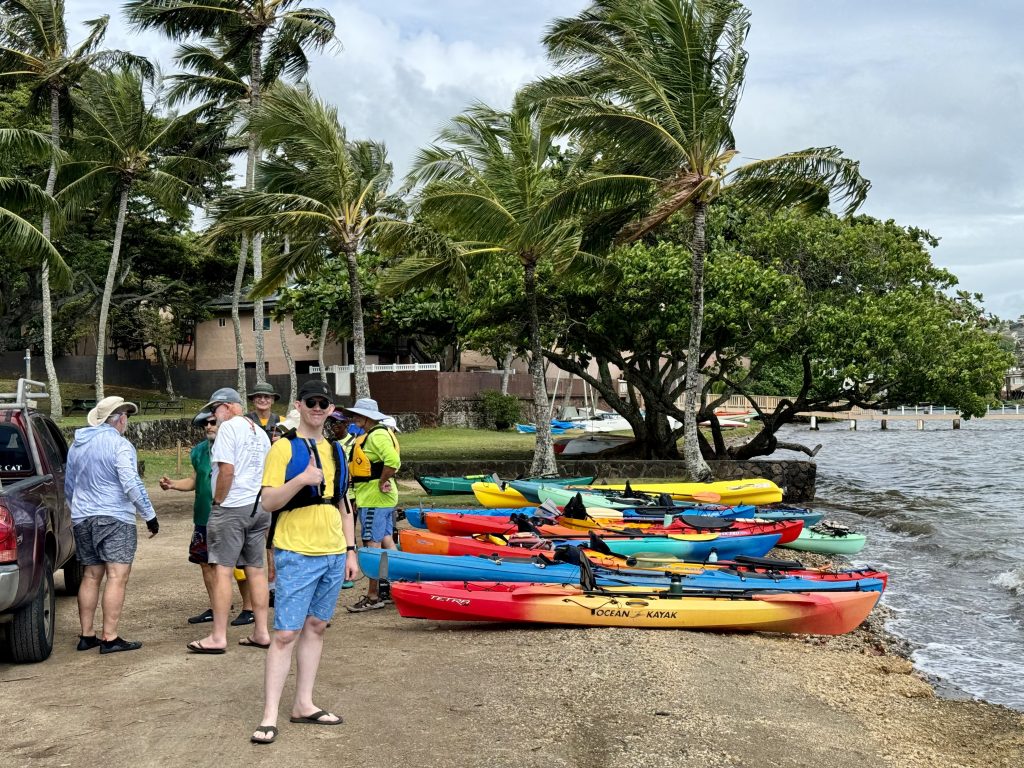
Positioning our cars for kayak drop-off at Runway Beach, and kayak pick-up upon conclusion at Keawa‘ula Beach, used much more of the day than paddling. Since there are no public access roads that follow around Ka‘ena Point, we had to travel south to clear the Wai‘anae Mountain Range. One hour and 36 speed bumps one way, allow time for the impromptu engineering of all that enables the human predicament. Into Waipahu and then back up the coast, then back again through the middle of the Island. I passed Schofield Barracks four times that day. Sitting is not a good posture to hold before a long paddle (and even after). When we three met at the initial kayak drop-off, Stan had already mapped small beach-like coves where we could ditch if things became too daunting. But that was not my actual apprehension at the time, because I arrived at Runway Beach with excretable urgency. I took off in search of hearsay facilities, and did not have Stan’s mobile number on my phone. My relief occurred in full after I called Stan’s home phone and told his wife that Stan can meet me at the men’s room at the local airport. Realizing that my message was lame, I sat in my car on the side of the road waiting for Stan to pass. My horn honks really well, he saw me, so I was fully relieved. We continued the morning pre-positioning cars for the day’s concluding operation homeward bound.
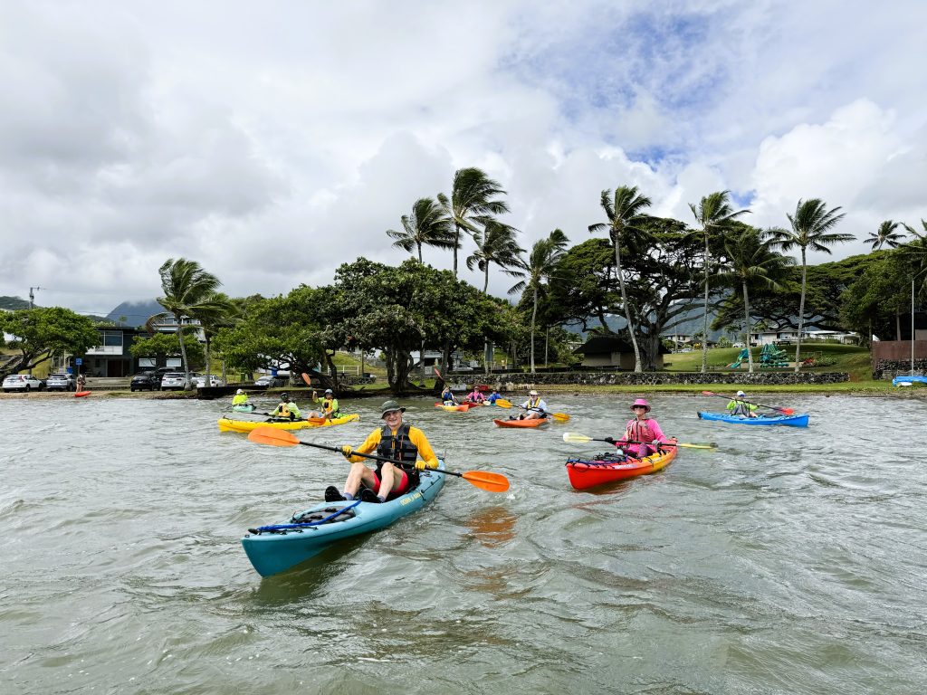
During the almost 3 hour wait, Sandy hung around Runway Beach. She saw eagle rays in the knee-deep shallow water, one big one and four smaller ones. When we finally returned, I thought they were manta rays, but I am now corrected. Eagle rays feed on mollusks and crustaceans off the seafloor, crushing their shells with their flattened teeth. Males will follow a female around for 2–3 days, chasing her into shallow water. Eagle ray females are much larger than the males. We all stood alert and saw a lot of thrashing and splash. One on top of the other. I cannot say we witnessed the bites of the female’s pectoral fin, or use of the male clasper, though watching sets of undulating bat wings in the surf from a calm section of shore was pure animal kingdom. After waiting most of the morning, it was no wonder that Sandy was the first one off the shore, showing us where to avoid the swells. With all this positioning and parking of cars, we finally started the paddle at noon. We all agreed to go, knowing that the weather was predicted to change that afternoon.
We started with 4 foot swells, a few 5 foot ones, and Stan followed us from the rear. I was the farthest out, and still two waves broke into me. The conditions didn’t change until the last half mile from the rocky point. Stan gave us the alert about the submerged rocks at the rocky point. Stay clear of the vortex at the tip, but don’t go far out, was his message. You’ll have trouble getting back. Sandy and I were in a merging vector headed for a point 100 feet away from swirling rough surf at the rocky tip. I was catching bigger swells from behind. They would lift the kayak forward. Adrenaline was coursing, ready to deal with any stiffness. Stan came fast from behind and went with Sandy first through the 40 yard gauntlet of danger. I was directly behind them by 30 yards and saw what happened. I don’t think they realize how big of a wave was coming at them. Their heads dipped down disappearing into ocean in front of me. They emerged wet, sideways and amazingly still in their kayaks. Stan scanned the wave swells behind me and told us to hold on tight. After a swell or two, he yells to Sandy ahead of us to, “GO! GO!” Stan and I waited another 15 seconds. He turns to me, “You go! GO!” We all churned that ocean to safety. As soon as we passed the tip of the point, we advanced with the rocky ridge on our left side. We just did the sharp left turn around the jutting horned corner of O‘ahu.

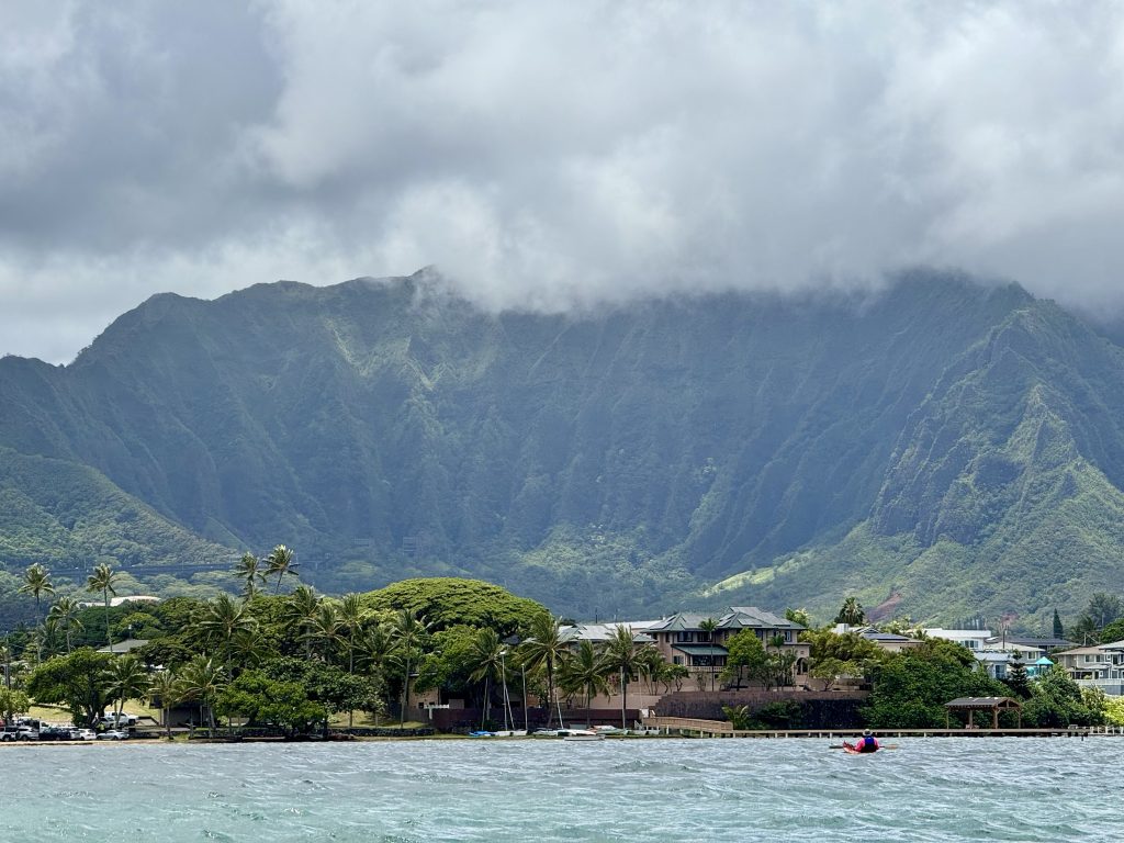
We were past the big swells, but the wind now whipped in our faces. Over the marine radio, Stan told Sandy and I to head into the wind directly and aim for the mountain. Go towards the eroded foundation stones that spanned the entire shore. There was calm respite from the wind the closer we were to the mountain. On the way there Sandy saw a young brown turtle who was curious about us. That turtle circled our kayaks, so we stopped to observe. While lifting the gaze, Ka‘ena Point Space Force Station is on the top of that mountain. Giant white golf ball radomes, with moving X-band antenna inside. Air is constantly pumped into the radome to pressurize it, and the outside has a coating that is hydrophobic. These radomes have no metal support beams would obscure the work with distances. This Space Force Station, opened in 1959, helps remotely track satellites in orbit, receives and processes data, and enables control of satellites by relaying commands from control centers. A geostationary satellite can only support users on 1/4 to 1/3 of the earth’s surface, so you need a ground antenna within that footprint if you want to communicate with someone in the adjacent satellite’s footprint. The detachment is in charge of supporting more than 185 satellites, performing mission operations around the world. Their missions include spaceflight, communications, reconnaissance, navigation, weather and ballistic missile early warning. Stories of the early Corona project and the KH-12 Hubble-sized Satellite Space Telescope are as interesting as the stories of our Hawaiian ancestors with their local intensity. Interesting, but do not get distracted or fidgety on an ocean kayak. I flipped my kayak and so lost my glasses and hat. Stan framed that moment to emphasize to us a basic and almost magical instruction. Keep the end of the paddle in the water at all times when you want to stay in balance. That it really works, makes this hack a true wisdom. Stan then gave me his yellow fanny pack to crown my head since we had 4 miles of bright sun left to paddle. With his years on the Island, Stan knows what a balding red sunburn feels like. He went looking for my hat but it wasn’t visible.
In 1899, the O‘ahu Railway and Land Company constructed a railway that encompassed 70 miles from Honolulu to Kahuku on the North Shore, to transport sugarcane. Most of these coastline tracks were destroyed by a tsunami in 1946. Our fearless paddle leader, Stan Dalbec, was a kid who rode on the closing O‘ahu Railway train trips, open to the public in 1947. In local history, this was the year of Dalbec 8 BCE (1 BCE was the year Stan Dalbec first wore shoes). These old train cars, which were used for cattle, cargo and third class, had a hole in the floorboards where you could loosen your bowels. Stan indicated that O‘ahu Railway and Land Company employed section gangs to maintain the tracks and clean up the dropped or tossed garbage. Stan said kids just stared down through the hole watching the tracks repeat. Stan had passing comments about the railway bed cut from the steep mountain side that we paddled adjacent. This volcanic stonework, exposed to constant shore breaking ocean, was fashioned artfully by mostly manual labor. Parts of the remaining stone buttressing foundation were visible under the trail from our vantage of the ocean.
It was Stan’s guidance on the whole last half of the paddle, after passing the fierce rock extended point, to get up close to the shore in order to avoid the damnable, dispositive wind. That end of the Wai‘anae Range provided amazing protection from the wind on the other side. And what was the other side? Oh, maybe I haven’t conveyed this… if you haven’t heard of the October wind and waves on the North Shore (nearby our launch beach), it’s your chance to contribute to the Selfie Encyclopedia of Rude Awakenings.
I botched the landing at Keawa‘ula Beach. I swiveled and stood in ankle-deep surf hunched, very stiff. I couldn’t stand straight fast enough. The boat and current threw my balance, and consequently the kayak drifted over me. I laid there a tangled with my paddle lash while the quick surf kept shifting my beached body. A few beachgoers helped me from this mess. Sandy fell to her knees and scrambled to pull the boat up. I didn’t see Stan, but I imagine his landing was as smooth as a shoe fitting at the mall. I realize now that the easier way to disembark would have been to jump out in waist deep water and push the kayak onto shore ahead of me. Make use of the water’s buoyancy for my back.

At day’s end, we all returned in Stan’s car to Runway Beach to gather all the kayaks and both cars back home. Stan has this white compact with two racks on top that span like antlers. He piled all three 15 footers on top. In route we checked our kayak count periodically with the bonnet shadow we could see on the sidewalk. Stan’s hatchback didn’t close, so air flow inside the vehicle was a fine tuning, lest we all fall asleep from the exhaust. The car talk ricochet around alcoholics, applying for work and the invasive Coconut Rhinoceros Beetle. These 4-5 inch insects look as if made from shoe leather. They are eating Hawaii’s palm trees, along with banana, hala and pineapples. Stan checked the palm trees we passed for telltale signs.
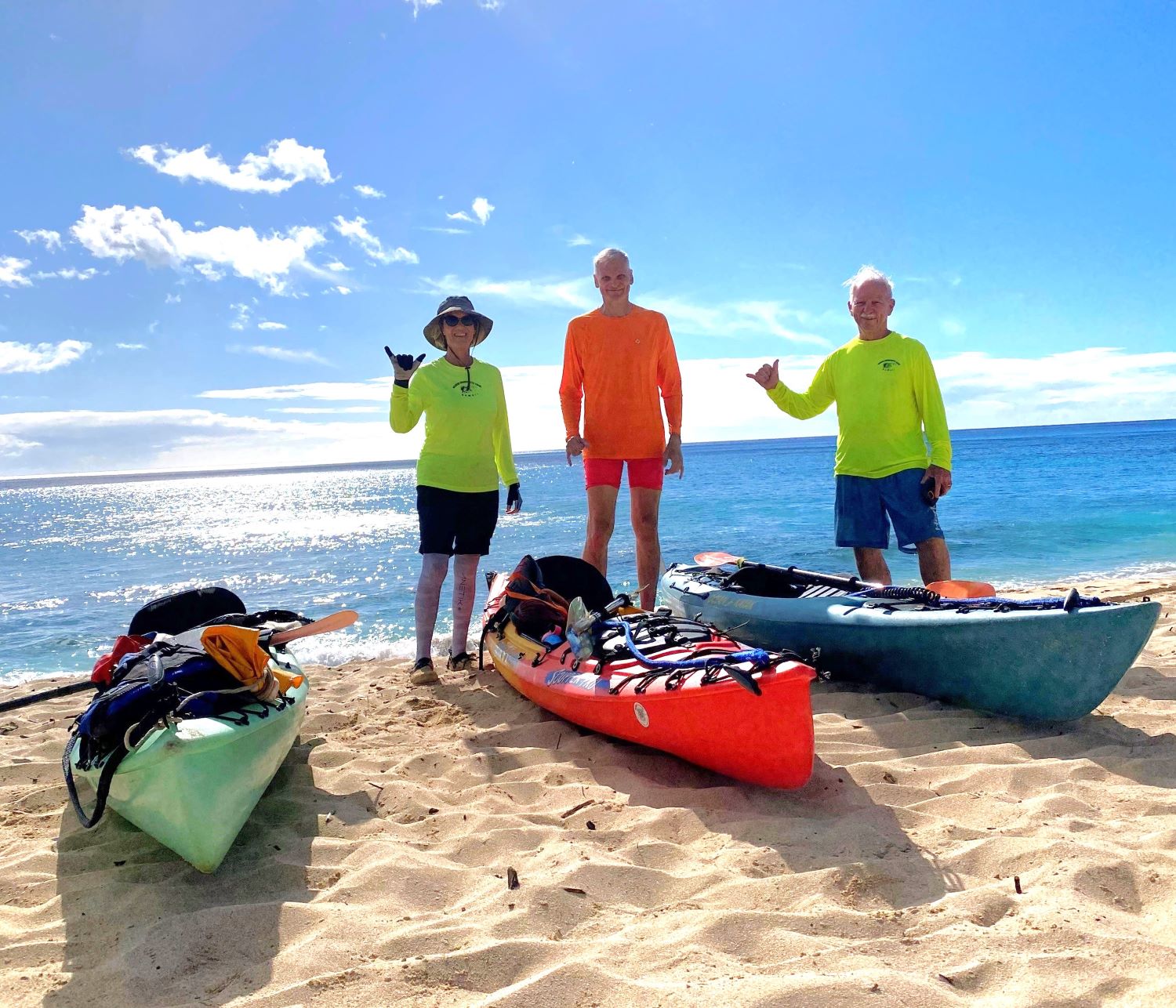
Sandy and I left our homes around 7 AM and Stan arrived home at 8:30 PM. A long day, but what a day! On the final trip homeward, Stan saved us the time and effort of moving the kayaks back onto the original car. He drove with all the kayaks aloft, with us, all the way back to Kāne‘ohe and unloaded them at our houses. He helped Sandy hoist her Scupper Pro onto the garage ceiling. Home at last, that leaping place for souls.